For the past week I had not been thinking much. Too many other things to do. If the work was not satisfactorily finished then let it fade away. There was now simply the practical necessity of installation, which really didn’t absorb me greatly. Installation seemed to be the point in which the work became opaque for me, in which it fell apart.
But yesterday I woke up with a greater sense of clarity. It was windy and raining. Autumn leaves were spread all across our back lawn. It occurred to me that ALMBWABPBIDCFERTIE is partly marked by the transition of seasons. The seven walks happened in the final few warm weeks of summer. Now there was a sudden shift to autumn. Now it made sense to do the walk one last time, to visit all the sites once more. To do this in the grimmest weather, with heavy rain pouring down.
Apart from returning to each individual scene of cutting and taking a photograph, I also had another idea. I would stop every fifteen minutes and draw a small map of the path I had followed in the previous quarter of an hour. Upon my return, I would assemble these fragmentary images into an overall map of the journey.
I dressed in appropriate lightweight wet weather gear and placed my camera and paper and pens in separate dry sacks. Then I put both sacks inside my day pack.
I left home at 9:15am, walking first up towards the Jumpers. I had the feeling I always have of starting up the steep hill too quickly – puffing after just a few hundred metres. I was especially aware of my breathing because I had my jacket hood pulled over my head to keep out the rain. The track was soaked. Rivers of water ran down the mountain bike track and pooled beneath the collapsed ramp jump near the fallen tree. I hopped up the muddy steps beside the boulder ramp, moving swiftly to stay warm and keep the leeches at bay.
I wondered how I could possibly get to all the sites in this weather. I was especially concerned about having to descend the steep forest beside the Mt Nebo slide. Bracketed my doubts and kept going.
The rain got heavier as I approached Mt Keira Road. The orange lights at the road block blinked on and off. I could see that I had some chance of reaching Byarong Park within 15 minutes so I switched from a walk to a jog.
There was a small National Parks cover at Byarong Park, but even then I could tell I was going to have trouble keeping my map drawing materials dry. I quickly sketched my rough path since I’d left home, jotted the time in the upper right corner of the page and got the next page ready. I had decided on an ‘Exquisite Corpse’ style approach, in which the last point at the top of any one page would provide the corresponding bottom point on the next page.
Placed everything back in my pack and headed off again, this time up the Ring Track towards the Jumpers. The steps were pools, but I was already so wet that it didn’t matter. Further up, waterfalls splashed down the steep bush beside the track. Everything was dark like dusk. I was half running, half walking.
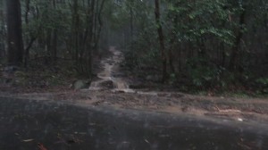
Another fifteen minutes up just a few hundred metres short of the Jumpers. No chance to get out of the rain. Everything drenched as I drew a quick map sketch and risked a single photograph of the track, which had become a small creek. No matter that the image is blurred.
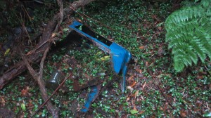
Followed the track up to the Jumpers and took a photograph of the cut that I had made in a blue panel (walk 5).
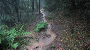
I also took another image of the flooded track.
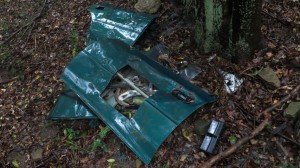
Hurried on again for a few minutes, but then realised that I had completely forgotten to photograph the other Jumpers vehicle that I had cut (walk 2). I had stupidly walked straight by it, mesmerised by the flowing path. I briefly considered not worrying about this omission, but then thought better and doubled-back. I also did some quick math, deciding to discount this detour from the current map drawing interval calculation. Within a few minutes I had retraced my steps and found my way down the gentle incline to the glistening green panel.
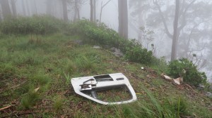
This mistake reminded me to be more attentive. In order to make up for lost time, I ran the next 10 minutes or so to the lone white car panel on Clive Bissel Drive (walk 3). A cold fog blew in from the coast, obscuring any possible view. I drew another small map and took a photograph.
An uphill slog back to Mt Keira Road. Feeling ok. Turned right towards Picton and Harry Graham Drive. The fog was so thick that I could scarcely make out the road ahead. Turned left at Harry Graham Drive and then immediately left again towards the Robertson Lookout walking track. Followed a power lines access road through deep pools of water to the track. Then pushed the pace again to get to Robertson Lookout within the fifteen minutes. I knew there was another small National Parks cover at the lookout, but at this stage it did not make a great deal of difference. The sheets of map paper were a gluggy, glutinous mess and I had to take great care to separate off any new sheet.
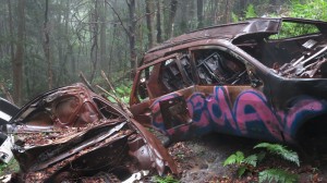
A sip of water and then descended the old forgotten trail that runs beneath the Harry Graham slides. Very quickly reached the rusted vehicle covered in purple graffiti (week 7).
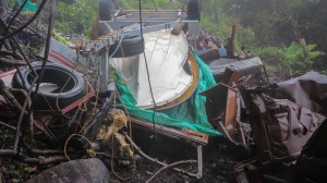
I decided to see if this low trail would connect to the next slide. Feeling a bit uncertain, I jogged along looking for any signs of burnt out forest and a high gap. Needn’t have worried. The trail led straight beneath the slide. Old tyres lay on either side of the path and variety of rolling detritus – soccer balls, hubcaps, bits and pieces of engines – led up to the wrecked cars themselves. The slope was very slippery, especially the barren section of ash just beneath the cars.
The rusted panel that I had photographed and cut (walk 6) was now largely obscured by a dumped boat and trailer.
I was standing only 10 metres below the road, but decided to descend back down to the track and see if it connected up with the track that leads down to the Water Board trail and Mt Nebo. The track grew increasingly faint as I headed South. I grew increasingly concerned that it would disappear altogether, but it eventually came out just where I expected. I hurried as quickly as possibly down through the rainforest and the slippery mountain bike track, stopping just once to draw another map.
I could feel myself tiring once I reached the relative ease of the Water Board track. Fifteen minutes elapsed and found myself at the top of the steep paved section. I tried to find some shelter from the rain, but it was useless. Still, I managed to find one last useable sheet of paper and sketched yet another hurried map.
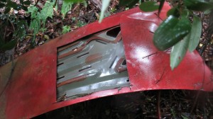
A few more minutes and I was standing at the top of the Mt Nebo slide. I committed myself to heading down. It was as slippery as I had expected and I had to cling to trees to have any chance of staying upright. Even then I often lost my footing and went sliding down the muddy slope. I hoped that it would be easier to get back out. Finally, I recognised the red panel at the bottom of the slide (walk 4), approaching it as carefully as possible to avoid sliding down further into the creek, which I could hear, but not see, roaring down in the undergrowth below.
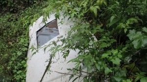
Just one panel to go – the very hardest of them all. By this stage I had become grimly determined and didn’t worry about constantly slipping over in the mud amidst car parts, lantana, stinging nettles and glass. And then there it was, right there, the final panel – the original white panel (walk 1) with its light lichen fur suspended in weeds in the middle of the slide. I took a photograph, but no image can do this place justice.
The struggle up the slope was much more difficult than I expected, perhaps because I was becoming increasingly tired. I strung together a line of trees, roots and junk to haul myself back up to the road.
From there it was just an easy stroll along O’Brien’s Road back to Mt Nebo and the descent down to Valley Drive. I stopped along O’Brien’s Road to draw one more map. The rain had stopped and drawing suddenly became easy. I should have drawn another map on the final descent, but I knew I had no hope of recovering another blank sheet. The map had become an undifferentiated wad of pages with ink seeping everywhere.
Byarong Creek was running high but I walked straight through it, unwilling to make the long detour across the Koloona Avenue bridge.
Walked the final few hundred metres home.
It was 12.50pm when I dropped my stuff beside the rear door.

